Strict Standards: Non-static method Loader::db() should not be called statically in /home/sites/frostedearth.co.uk/public_html/updates/concrete5.5.1/concrete/models/block.php on line 169
Strict Standards: Non-static method Loader::helper() should not be called statically in /home/sites/frostedearth.co.uk/public_html/updates/concrete5.5.1/concrete/models/block.php on line 170
Strict Standards: Non-static method Object::camelcase() should not be called statically in /home/sites/frostedearth.co.uk/public_html/updates/concrete5.5.1/concrete/libraries/loader.php on line 250
Strict Standards: Non-static method Cache::get() should not be called statically in /home/sites/frostedearth.co.uk/public_html/updates/concrete5.5.1/concrete/models/page.php on line 24
Strict Standards: Non-static method Cache::key() should not be called statically in /home/sites/frostedearth.co.uk/public_html/updates/concrete5.5.1/concrete/libraries/cache.php on line 117
Strict Standards: Non-static method Cache::getLibrary() should not be called statically in /home/sites/frostedearth.co.uk/public_html/updates/concrete5.5.1/concrete/libraries/cache.php on line 122
Strict Standards: Non-static method Loader::db() should not be called statically in /home/sites/frostedearth.co.uk/public_html/updates/concrete5.5.1/concrete/models/page.php on line 26
Strict Standards: Non-static method Cache::set() should not be called statically in /home/sites/frostedearth.co.uk/public_html/updates/concrete5.5.1/concrete/models/page.php on line 28
Strict Standards: Non-static method Cache::key() should not be called statically in /home/sites/frostedearth.co.uk/public_html/updates/concrete5.5.1/concrete/libraries/cache.php on line 101
Strict Standards: Non-static method Cache::getLibrary() should not be called statically in /home/sites/frostedearth.co.uk/public_html/updates/concrete5.5.1/concrete/libraries/cache.php on line 103
Strict Standards: Non-static method Cache::key() should not be called statically in /home/sites/frostedearth.co.uk/public_html/updates/concrete5.5.1/concrete/libraries/cache.php on line 107
Strict Standards: Non-static method Loader::db() should not be called statically in /home/sites/frostedearth.co.uk/public_html/updates/concrete5.5.1/concrete/models/collection_version.php on line 38
Strict Standards: Non-static method Area::getOrCreate() should not be called statically in /home/sites/frostedearth.co.uk/public_html/updates/concrete5.5.1/concrete/models/block.php on line 59
Strict Standards: Non-static method Area::get() should not be called statically in /home/sites/frostedearth.co.uk/public_html/updates/concrete5.5.1/concrete/models/area.php on line 160
Strict Standards: Non-static method Cache::get() should not be called statically in /home/sites/frostedearth.co.uk/public_html/updates/concrete5.5.1/concrete/models/area.php on line 127
Strict Standards: Non-static method Cache::key() should not be called statically in /home/sites/frostedearth.co.uk/public_html/updates/concrete5.5.1/concrete/libraries/cache.php on line 117
Strict Standards: Non-static method Cache::getLibrary() should not be called statically in /home/sites/frostedearth.co.uk/public_html/updates/concrete5.5.1/concrete/libraries/cache.php on line 122
Strict Standards: Non-static method Loader::db() should not be called statically in /home/sites/frostedearth.co.uk/public_html/updates/concrete5.5.1/concrete/models/area.php on line 132
Strict Standards: Non-static method Cache::set() should not be called statically in /home/sites/frostedearth.co.uk/public_html/updates/concrete5.5.1/concrete/models/area.php on line 147
Strict Standards: Non-static method Cache::key() should not be called statically in /home/sites/frostedearth.co.uk/public_html/updates/concrete5.5.1/concrete/libraries/cache.php on line 101
Strict Standards: Non-static method Cache::getLibrary() should not be called statically in /home/sites/frostedearth.co.uk/public_html/updates/concrete5.5.1/concrete/libraries/cache.php on line 103
Strict Standards: Non-static method Cache::key() should not be called statically in /home/sites/frostedearth.co.uk/public_html/updates/concrete5.5.1/concrete/libraries/cache.php on line 107
Strict Standards: Non-static method Cache::get() should not be called statically in /home/sites/frostedearth.co.uk/public_html/updates/concrete5.5.1/concrete/models/block.php on line 63
Strict Standards: Non-static method Cache::key() should not be called statically in /home/sites/frostedearth.co.uk/public_html/updates/concrete5.5.1/concrete/libraries/cache.php on line 117
Strict Standards: Non-static method Cache::getLibrary() should not be called statically in /home/sites/frostedearth.co.uk/public_html/updates/concrete5.5.1/concrete/libraries/cache.php on line 122
Strict Standards: Non-static method Loader::db() should not be called statically in /home/sites/frostedearth.co.uk/public_html/updates/concrete5.5.1/concrete/models/block.php on line 73
Strict Standards: Non-static method Loader::controller() should not be called statically in /home/sites/frostedearth.co.uk/public_html/updates/concrete5.5.1/concrete/models/block_types.php on line 257
Strict Standards: Non-static method Object::camelcase() should not be called statically in /home/sites/frostedearth.co.uk/public_html/updates/concrete5.5.1/concrete/libraries/loader.php on line 396
Strict Standards: Non-static method Loader::db() should not be called statically in /home/sites/frostedearth.co.uk/public_html/updates/concrete5.5.1/concrete/models/collection_types.php on line 80
Strict Standards: Non-static method Loader::controller() should not be called statically in /home/sites/frostedearth.co.uk/public_html/updates/concrete5.5.1/concrete/models/block_types.php on line 257
Strict Standards: Non-static method Object::camelcase() should not be called statically in /home/sites/frostedearth.co.uk/public_html/updates/concrete5.5.1/concrete/libraries/loader.php on line 396
Frosted Earth
|
Max Temps for Monday 5th Sept. 23C Min Temps 15C Monday night.
|
|
Weather for Monday 5th September 2022.
A rather unsettled day although there will be some sunny intervals and drier spells but some showers are likely and they could be heavy with thunder. Sunday night brought some active storms with very strong downdrafts giving gale force gusts of winds. There was some hail too with lightning flashes coming in at our weather station at a rate of over 65 per minute.
It will still be on the warm side with southerly light to moderate winds. Further showers with perhaps thunder overnight Monday and a repeat performance on both Tuesday and Wednesday.
At 10.00 hrs GMT on 5th September at Heath Common: Current temps: 18.3C. Weather: Fair. Air pressure: 1017 hPa :Rising slowly. Rainfall so far this month to 09.00hrs GMT today: 7.3 mm.
Stay safe, stay well. Listen out for me next on Sunday 2nd October on BBC Radio Surrey and Sussex at 13.10 hrs on the 'Dig It' show looking back on September's Weather and ahead for October. If you have a weather question contact the programme or here on this site's contact page or what about a pack of magazines as a present.
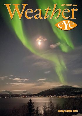
Issue 43 of Weather eye magazine have been sent to subscribers. I am now starting Issue 44. I do need articles which so far are slow to come in.
A gift pack available only £7 including folder and postage.
Weather eye magazine issue 43 has been sent out. Do try a complimentary copy.
Strict Standards: Non-static method PermissionsCache::exists() should not be called statically in /home/sites/frostedearth.co.uk/public_html/updates/concrete5.5.1/concrete/models/permissions.php on line 69 Strict Standards: Non-static method PermissionsCache::getIdentifier() should not be called statically in /home/sites/frostedearth.co.uk/public_html/updates/concrete5.5.1/concrete/models/permissions.php on line 15 Strict Standards: Non-static method PermissionsCache::getObject() should not be called statically in /home/sites/frostedearth.co.uk/public_html/updates/concrete5.5.1/concrete/models/permissions.php on line 70 Strict Standards: Non-static method PermissionsCache::getIdentifier() should not be called statically in /home/sites/frostedearth.co.uk/public_html/updates/concrete5.5.1/concrete/models/permissions.php on line 45 Strict Standards: Non-static method Loader::db() should not be called statically in /home/sites/frostedearth.co.uk/public_html/updates/concrete5.5.1/concrete/models/stack/model.php on line 102 Strict Standards: Non-static method Loader::db() should not be called statically in /home/sites/frostedearth.co.uk/public_html/updates/concrete5.5.1/concrete/models/collection_version.php on line 38 Strict Standards: Non-static method Cache::get() should not be called statically in /home/sites/frostedearth.co.uk/public_html/updates/concrete5.5.1/concrete/models/page.php on line 24 Strict Standards: Non-static method Cache::key() should not be called statically in /home/sites/frostedearth.co.uk/public_html/updates/concrete5.5.1/concrete/libraries/cache.php on line 117 Strict Standards: Non-static method Loader::db() should not be called statically in /home/sites/frostedearth.co.uk/public_html/updates/concrete5.5.1/concrete/models/collection_version.php on line 38 Strict Standards: Non-static method Area::get() should not be called statically in /home/sites/frostedearth.co.uk/public_html/updates/concrete5.5.1/concrete/models/stack/model.php on line 40 Strict Standards: Non-static method Cache::get() should not be called statically in /home/sites/frostedearth.co.uk/public_html/updates/concrete5.5.1/concrete/models/area.php on line 127 Strict Standards: Non-static method Cache::key() should not be called statically in /home/sites/frostedearth.co.uk/public_html/updates/concrete5.5.1/concrete/libraries/cache.php on line 117 Strict Standards: Non-static method Area::getOrCreate() should not be called statically in /home/sites/frostedearth.co.uk/public_html/updates/concrete5.5.1/concrete/models/block.php on line 59 Strict Standards: Non-static method Area::get() should not be called statically in /home/sites/frostedearth.co.uk/public_html/updates/concrete5.5.1/concrete/models/area.php on line 160 Strict Standards: Non-static method Cache::get() should not be called statically in /home/sites/frostedearth.co.uk/public_html/updates/concrete5.5.1/concrete/models/area.php on line 127 Strict Standards: Non-static method Cache::key() should not be called statically in /home/sites/frostedearth.co.uk/public_html/updates/concrete5.5.1/concrete/libraries/cache.php on line 117 Strict Standards: Non-static method Cache::get() should not be called statically in /home/sites/frostedearth.co.uk/public_html/updates/concrete5.5.1/concrete/models/block.php on line 63 Strict Standards: Non-static method Cache::key() should not be called statically in /home/sites/frostedearth.co.uk/public_html/updates/concrete5.5.1/concrete/libraries/cache.php on line 117
See Also 'On This Day' in the Publications section.
Strict Standards: Non-static method PermissionsCache::exists() should not be called statically in /home/sites/frostedearth.co.uk/public_html/updates/concrete5.5.1/concrete/models/permissions.php on line 69 Strict Standards: Non-static method PermissionsCache::getIdentifier() should not be called statically in /home/sites/frostedearth.co.uk/public_html/updates/concrete5.5.1/concrete/models/permissions.php on line 15 Strict Standards: Non-static method PermissionsCache::getObject() should not be called statically in /home/sites/frostedearth.co.uk/public_html/updates/concrete5.5.1/concrete/models/permissions.php on line 70 Strict Standards: Non-static method PermissionsCache::getIdentifier() should not be called statically in /home/sites/frostedearth.co.uk/public_html/updates/concrete5.5.1/concrete/models/permissions.php on line 45 Strict Standards: Non-static method Loader::db() should not be called statically in /home/sites/frostedearth.co.uk/public_html/updates/concrete5.5.1/concrete/models/stack/model.php on line 102 Strict Standards: Non-static method Loader::db() should not be called statically in /home/sites/frostedearth.co.uk/public_html/updates/concrete5.5.1/concrete/models/collection_version.php on line 38 Strict Standards: Non-static method Cache::get() should not be called statically in /home/sites/frostedearth.co.uk/public_html/updates/concrete5.5.1/concrete/models/page.php on line 24 Strict Standards: Non-static method Cache::key() should not be called statically in /home/sites/frostedearth.co.uk/public_html/updates/concrete5.5.1/concrete/libraries/cache.php on line 117 Strict Standards: Non-static method Loader::db() should not be called statically in /home/sites/frostedearth.co.uk/public_html/updates/concrete5.5.1/concrete/models/collection_version.php on line 38 Strict Standards: Non-static method Area::get() should not be called statically in /home/sites/frostedearth.co.uk/public_html/updates/concrete5.5.1/concrete/models/stack/model.php on line 40 Strict Standards: Non-static method Cache::get() should not be called statically in /home/sites/frostedearth.co.uk/public_html/updates/concrete5.5.1/concrete/models/area.php on line 127 Strict Standards: Non-static method Cache::key() should not be called statically in /home/sites/frostedearth.co.uk/public_html/updates/concrete5.5.1/concrete/libraries/cache.php on line 117 Strict Standards: Non-static method Area::getOrCreate() should not be called statically in /home/sites/frostedearth.co.uk/public_html/updates/concrete5.5.1/concrete/models/block.php on line 59 Strict Standards: Non-static method Area::get() should not be called statically in /home/sites/frostedearth.co.uk/public_html/updates/concrete5.5.1/concrete/models/area.php on line 160 Strict Standards: Non-static method Cache::get() should not be called statically in /home/sites/frostedearth.co.uk/public_html/updates/concrete5.5.1/concrete/models/area.php on line 127 Strict Standards: Non-static method Cache::key() should not be called statically in /home/sites/frostedearth.co.uk/public_html/updates/concrete5.5.1/concrete/libraries/cache.php on line 117 Strict Standards: Non-static method Cache::get() should not be called statically in /home/sites/frostedearth.co.uk/public_html/updates/concrete5.5.1/concrete/models/block.php on line 63 Strict Standards: Non-static method Cache::key() should not be called statically in /home/sites/frostedearth.co.uk/public_html/updates/concrete5.5.1/concrete/libraries/cache.php on line 117
The Coming Week from
Strict Standards: Non-static method PermissionsCache::exists() should not be called statically in /home/sites/frostedearth.co.uk/public_html/updates/concrete5.5.1/concrete/models/permissions.php on line 69 Strict Standards: Non-static method PermissionsCache::getIdentifier() should not be called statically in /home/sites/frostedearth.co.uk/public_html/updates/concrete5.5.1/concrete/models/permissions.php on line 15 Strict Standards: Non-static method PermissionsCache::getObject() should not be called statically in /home/sites/frostedearth.co.uk/public_html/updates/concrete5.5.1/concrete/models/permissions.php on line 70 Strict Standards: Non-static method PermissionsCache::getIdentifier() should not be called statically in /home/sites/frostedearth.co.uk/public_html/updates/concrete5.5.1/concrete/models/permissions.php on line 45Weather Centre
The Chipstead Valley weather station lies within a dry, chalkland valley on the dip slope of the North Downs. The valley is around 60 metres deep.
Read about the Chipstead Valley Station
Strict Standards: Non-static method PermissionsCache::exists() should not be called statically in /home/sites/frostedearth.co.uk/public_html/updates/concrete5.5.1/concrete/models/permissions.php on line 69 Strict Standards: Non-static method PermissionsCache::getIdentifier() should not be called statically in /home/sites/frostedearth.co.uk/public_html/updates/concrete5.5.1/concrete/models/permissions.php on line 15 Strict Standards: Non-static method PermissionsCache::getObject() should not be called statically in /home/sites/frostedearth.co.uk/public_html/updates/concrete5.5.1/concrete/models/permissions.php on line 70 Strict Standards: Non-static method PermissionsCache::getIdentifier() should not be called statically in /home/sites/frostedearth.co.uk/public_html/updates/concrete5.5.1/concrete/models/permissions.php on line 45 Strict Standards: Non-static method Loader::db() should not be called statically in /home/sites/frostedearth.co.uk/public_html/updates/concrete5.5.1/concrete/models/stack/model.php on line 102 Strict Standards: Non-static method Loader::db() should not be called statically in /home/sites/frostedearth.co.uk/public_html/updates/concrete5.5.1/concrete/models/collection_version.php on line 38 Strict Standards: Non-static method Cache::get() should not be called statically in /home/sites/frostedearth.co.uk/public_html/updates/concrete5.5.1/concrete/models/page.php on line 24 Strict Standards: Non-static method Cache::key() should not be called statically in /home/sites/frostedearth.co.uk/public_html/updates/concrete5.5.1/concrete/libraries/cache.php on line 117 Strict Standards: Non-static method Loader::db() should not be called statically in /home/sites/frostedearth.co.uk/public_html/updates/concrete5.5.1/concrete/models/collection_version.php on line 38 Strict Standards: Non-static method Area::get() should not be called statically in /home/sites/frostedearth.co.uk/public_html/updates/concrete5.5.1/concrete/models/stack/model.php on line 40 Strict Standards: Non-static method Cache::get() should not be called statically in /home/sites/frostedearth.co.uk/public_html/updates/concrete5.5.1/concrete/models/area.php on line 127 Strict Standards: Non-static method Cache::key() should not be called statically in /home/sites/frostedearth.co.uk/public_html/updates/concrete5.5.1/concrete/libraries/cache.php on line 117 Strict Standards: Non-static method Area::getOrCreate() should not be called statically in /home/sites/frostedearth.co.uk/public_html/updates/concrete5.5.1/concrete/models/block.php on line 59 Strict Standards: Non-static method Area::get() should not be called statically in /home/sites/frostedearth.co.uk/public_html/updates/concrete5.5.1/concrete/models/area.php on line 160 Strict Standards: Non-static method Cache::get() should not be called statically in /home/sites/frostedearth.co.uk/public_html/updates/concrete5.5.1/concrete/models/area.php on line 127 Strict Standards: Non-static method Cache::key() should not be called statically in /home/sites/frostedearth.co.uk/public_html/updates/concrete5.5.1/concrete/libraries/cache.php on line 117 Strict Standards: Non-static method Cache::get() should not be called statically in /home/sites/frostedearth.co.uk/public_html/updates/concrete5.5.1/concrete/models/block.php on line 63 Strict Standards: Non-static method Cache::key() should not be called statically in /home/sites/frostedearth.co.uk/public_html/updates/concrete5.5.1/concrete/libraries/cache.php on line 117 Strict Standards: Non-static method Area::getOrCreate() should not be called statically in /home/sites/frostedearth.co.uk/public_html/updates/concrete5.5.1/concrete/models/block.php on line 59 Strict Standards: Non-static method Area::get() should not be called statically in /home/sites/frostedearth.co.uk/public_html/updates/concrete5.5.1/concrete/models/area.php on line 160 Strict Standards: Non-static method Cache::get() should not be called statically in /home/sites/frostedearth.co.uk/public_html/updates/concrete5.5.1/concrete/models/area.php on line 127 Strict Standards: Non-static method Cache::key() should not be called statically in /home/sites/frostedearth.co.uk/public_html/updates/concrete5.5.1/concrete/libraries/cache.php on line 117 Strict Standards: Non-static method Cache::get() should not be called statically in /home/sites/frostedearth.co.uk/public_html/updates/concrete5.5.1/concrete/models/block.php on line 63 Strict Standards: Non-static method Cache::key() should not be called statically in /home/sites/frostedearth.co.uk/public_html/updates/concrete5.5.1/concrete/libraries/cache.php on line 117This day July 15th 1949
On this St. Swithun’s Day severe storms in the Midlands and East Anglia. At March in Cambridgeshire 105mm of rain fell in 105 minutes. There was widespread flooding with the Fire Brigade pumping out many properties. Fields were flooded and crops of potatoes ruined and it was especially bad at Doddington. The river rose over a foot remarkable for a summer month when the level normally falls.
In 1881 the heatwave reached a peak with 35C in London.
In the remarkable summer of 1976 a Minister of Drought was appointed- Denis Howell.
Strict Standards: Non-static method PermissionsCache::exists() should not be called statically in /home/sites/frostedearth.co.uk/public_html/updates/concrete5.5.1/concrete/models/permissions.php on line 69 Strict Standards: Non-static method PermissionsCache::getIdentifier() should not be called statically in /home/sites/frostedearth.co.uk/public_html/updates/concrete5.5.1/concrete/models/permissions.php on line 15 Strict Standards: Non-static method PermissionsCache::getObject() should not be called statically in /home/sites/frostedearth.co.uk/public_html/updates/concrete5.5.1/concrete/models/permissions.php on line 70 Strict Standards: Non-static method PermissionsCache::getIdentifier() should not be called statically in /home/sites/frostedearth.co.uk/public_html/updates/concrete5.5.1/concrete/models/permissions.php on line 45
Follow Frosted Earth
Keep up to date with forecasts and weather warnings. Subscribe to our RSS feeds, follow frosted earth on Twitter or become a fan on Facebook.


